This went through my mind as I thrashed my aging car along the A82 towards Tyndrum. I was actually heading to Taynuilt which would leave a 10 mile bike ride to Oban where I was to catch the boat to South Uist. As usual I'd got my timings mixed up, so instead of a leisurely cruise along the road I was pedal to the metal in order to give me enough time to get the boat. Fortunately traffic was near non-existent at this early hour so I got to Taynuilt with about 1hr before my ferry was due to depart. A quick extraction of bike, put on shoes, lid and gloves, double check everything was on bike, lock car and go. The wee road to Oban from Taynuilt is a gem but does involve a reasonable climb. I was trying not to go too hard but as usual when I'm on a tight timescale I was pushing as hard as I could. At least the nice descent into Oban allowed me to catch my breath and cool off. The ferry was 15 minutes away thanks to my pace so I had time to get tickets and relax.

Sun over Mull. The sailing across to Lochboisdale takes around 5 hours and mixing bikes with ferries is definitely an all round good thing, you get to relax, eat lots of food (Calmac catering is good and surprisingly reasonably priced), and watch the fabulous scenery that is the minches. I also saw dolphins and a couple of minky whales as well as the tale flukes of something bigger - maybe a humback? The stresses of work and my mad dash over to Taynuilt evaporated in the morning sun.

As the boat docked in Lochboisdale a shower had just passed so it was into pleasant sunshine as I pedaled west to pick up the Machair path. This is a good track that runs up a chunk of the west coast of South Uist that I had ridden in 2012 after doing the beaches on the fat bike with friends. Another shower came in but it was short lived. The track is generally grassy with a few sandy bits. A map appraisal indicates some gaps but its all there on the ground. One section cuts through the golf course which is also grazed by cows, not something you would see on the Old Course.... You also pass by miles of white sandy beaches.
The landscape is unique here - quite flat with a few low hills towards the east and no trees. Therein lies the problem - if the weather turns nasty there is nowhere to hide. That said there are a few hostels on the outer Hebrides, run by the Gatliff trust http://www.gatliff.org.uk/ and affiliated to the SYHA. They are basic hostels with space to camp and well worth considering if you are looking for shelter. Wild camping is possible in many places and generally welcomed by residents as long as you follow the usual rules.

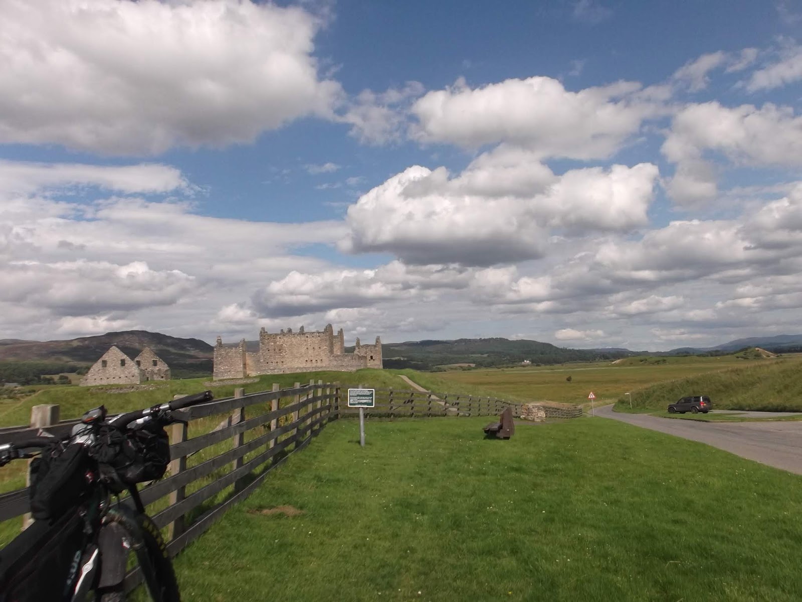
The causeway between South Uist and Benbecula
I passed by Howmore hostel but it was only 5 so too early to stop. Shortly after this the route takes you back to the road but this also makes for pleasant cycling. I followed this over the causeway to Benbecula, quickly passed through and onto North Uist past another great wee campsite we'd used in 2012 and then up the main road to Loch Maddy. The forecast was not looking great so I was hoping to find digs here which would give an easy pedal to the Harris ferry the next day. This was in an independent hostel that was also an outdoor centre. A few bikers were there but they headed to the pub shortly afterwards. No-one else was in evidence so I got a room to myself. A quick shop got food and a few beers and I settled in for a pleasant evening.

Sunset over Loch Maddy
The next morning was a bit damp and breezy so after a leisurely breakfast in the art centre cum café I hightailed it north to Bernaray to catch the Harris boat. This follows a convoluted route through a maze of tiny islets. A glance at the marine chart on the lounge wall shows why the ferry does so many twists and turns - the sea depth is often 2m or less and in particularly low tides it won't run.

From Leverburgh I followed the east coast road - a sinuous route following the coastline but with many ups and downs through the rocky landscape. It was still very grey but no rain fell and as I reached Tarbet there was a hint of the sky clearing. The signs of progress were everywhere - open shops, despite it being a Sunday! On my 2010 trip everything was firmly closed, a consequence of the strict religious nature of a decreasing minority of islanders. As more and more tourists have come to visit, and more and more people want to cash in on this, Sunday closing taboos have progressively reduced until now its pretty much the same as on the mainland. I don't care about the pros and cons of this, all I care about is being able to get food and drink on a Sunday. Previously Sundays had to be carefully planned with enough food to last all day. And if it rained, you were out in it!
From Tarbet I was heading for a trail that would take me to Rhenighidale hostel. On paper it looks somewhat precipitous but friends had done it and pronounced it a corker. On the steady climb away from the road I met a local mountainbiker to whom I chatted for a good half hour about our respective mountainbiking experiences. Eventually we went our separate ways leaving me to my own world again.

The descent was steep and nadgery, just how I like it. A short push out of a gorge lead to more ace riding coming out on the road just as it descends to Rhenigidale. The last time I was here I rode in from the main north / south road which required a big climb, a descent back to sea level, another big climb and then back to sea level again. I faced this tomorrow...


Looking along the trail to Rhenigidale
Again I couldn't be bothered pitching my tent so settled into the hostel for another pleasant evening. Also in residence was a couple of guys who were hill walking in the area plus a couple of Spanish women who kept themselves to themselves. I chatted to the hill walkers for a while (and drank their whisky) then turned in.

Compact and bijou, Rhenigidale Hostel
Waking up the next morning I noted that all the others had gone. I was fairly chilled as I only had 35 miles to ride on the road to Stornaway to get the boat to Ullapool. Then I looked at my watch - 10.45. I did a double take before realising this was indeed the time... So much for an early start and a leisurely ride. I hastily finished breakfast packed up and left. There followed another mad thrash and as usual the wind had shifted to the North West making for a stiff headwind. The last time I did this I had more time but the wind was gale force so it took ages. Now here I was again, racing a ferry timetable. Still; it was sunny and the hills passed easily. Thereafter the road is fairly level and very quiet. I got to the port in good time in the event and once on board ship indulged myself again in a large meal.
At Ullapool I stocked up with supplies and then it was decision time. The adventurous route would be to head south through Fisherfield and then follow the Highland Trail Route backwards to near Tyndrum before heading back to the car. But this was a big undertaking and the weather forecast wasn't that great. Plus having been through that May it was not as though I needed to do it again. But I was keen to scope out an easier way in and also to check out an alternative exit via the 'Postmans Path' from Letterewe to Kinlochewe. Alan Goldsmith, route setter for the Highland trail had mentioned this route in an email exchange we had been having about changes to the first day route. He was thinking of putting it into the HT route and was keen for someone else to check it out.
So off I set heading east along the A835, turning off at Croftown. Where the HT route leaps up the Coffin Road I kept straight on until the road became a track. I followed this for a few K until it came to a vague end just before a wooded glen with a small river flowing through it. I was aiming for a bridge shown on the map. If I could get across it I would be able to pick up a new track built as part of a micro hydro scheme up onto the Gairloch road (This is marked on the 1:25k OS). A mile or so along this I'd turn off to Loch a Bhraoin, follow a track to its head and then a singletrack into the Strath na Sealga and Sheneval bothy.

That night I hatched a plan. I was fancying some socialising so decided I would ride through to Aviemore, a trip of around 110miles. I was up early and away by 7am. Instead of reversing the HT route I missed out Ullapool hill and road up through the quarry. At Loch an Daimh I carried straight on a rough double track. Its marked on the OS as single but its double all the way through. The weather was clear and there wasn't a breath of wind. Unfortunately the midges were cashing in on this, hovering in clouds to wait for a sweaty bikepacker to pass by. As I was the only one, I got their full attention.... Knockdamph bothy provided shelter from the biting menaces for a second breakfast and then it was onwards towards the days second bothy, the Schoolhouse. What amazed me was the dryness of the trails. After the wet of the 2015 HT group start it was like a different world and very welcome.
I knew the weather was to change early afternoon so made the most of the sun. On the climb over to Strath Cuileannach I paused frequently to take in the views.

I was amazed to be able to see Suilven and Canisp. During both my Highland Trail rides, this had been a cloud down / zero visibility traverse and hadn't realised that these spectacular bumps were visible this far away. Back tracking the HT route also felt strange, memories of the group start still fresh in my mind along with the people I was riding with and all of the chat we had. Pedaling steadily up towards Deanich Lodge I made a fine discovery - a partially buried fishing bothy that was unlocked and looked out onto the river. I paused for lunch and made a mental note to get here one evening for a bivvy.
On the climb over to Strath Vaich the sun finally departed under the growing cloud. I was making good progress however due to a stiff tailwind and in seemingly no time I was at Contin, availing myself of the shop. From here I would leave the HT route and strike south east to Inverness. In fact from here to Aviemore would be nearly all on road but I was quite happy with this as this trip was most definitely a tour, not a race!
From Contin there is a few miles of A road bashing to Muir of Ord, but a couple of miles past this you turn off on a great wee road along the north side of the Beauly Firth. The on / off drizzle became incessant rain here so it was on with the water proofs, grin and bear it. At the Kessock bridge I picked up NCN 1 and followed this (with a few minor detours) to the centre of Inverness. A snack and a cuppa in the Velocity cafe and bike workshop fortified me for the steady climb out of Shnecky up over the Slochd to Speyside.
NCN 7 follows a rather long route to try to avoid the worst of the climb but I know this area well so took a large shortcut up through Culloden, and then a couple of wee roads to rejoin the NCN. The rain was continuous but I felt pretty strong as I passed the 100 mile mark. The NCN follows a mix of the old A9 and various bits of cycleway through Moy, Tomatin and finally over the Slochd pass at nigh on 400m. Carbridge followed soon after and in view of the rain I stayed on road to Aviemore. My friends were very accommodating supplying drying facilities and a bed. In return I paid for our meal and beers in the Ski an Doo restaurant in town.
The next days plan was to head down to Dalwhinnie and into the Ben Alder area. This has become on of my favourite riding areas and I was keen to tackle the ace single track over the Bealach Dubh - a mountain bike classic route. I'd worked out this route for this trip:- Aviemore to Dalwhinnie, down by Loch Ericht, over to Loch Pattack, up and over the Bealach Dubh / Cumhain to Ben alder Cottage. Then; down to Loch Rannoch, over the Lairig Ghallabaich to Glen Lyon and finally the clincher - a track alongside Loch Lyon which connected over to the West Highland Way a few miles out of Tyndrum but wasn't shown on the OS map. I'd discovered it whilst looking at aerial photos of the area a few years ago and it looked a goer all the way with only a few river crossings of concern given the previous days rain.
Alan G had been chatting at that years Highland Trail about wanting to get the outward route off the West Highland Way as he was worried about a big group of bikes mixing it up with the usual WHW crowd. He'd emailed me soon after, suggesting the route head west from Loch Tulla to Loch Etive and up the single track. I'd noted that this was a bit of a marginal route these days... I had thought of getting the Ben Alder area into the route but this only seemed to work if you switched the start to Blair Atholl or Pitlochry, neither of which were an option for Alan. The revelation was the planning for this trip. You could reverse the above route and hey presto, a new day one route - Tyndrum down to Auch Farm, up and over to Loch Lyon, down the glen to Bridge of Balgie, over to Rannoch, up to Ben Alder Cottage, over the Beallach dubh and down the Pattack to connect to the current route at Loch Lagan - simples!
So today would be a means of scoping this out and then it would be up to Alan. I had a leisurely start at about 1pm and then cruised down the back road (also NCN 7) to Newtonmore. I stopped for a meal and to pick up supplies and then continued on NCN 7 to Dalwhinnie.
To this point it had been sunny if breezy. As I looked down to Loch Ericht however all I could see was a wall of cloud. Sure enough as I started on the big track, in came the horizontal dreich, the same as had accompanied us around the Highland Trail route day after day... Nowt for it but to get the gear on and keep going. I'd thought of getting over to Ben Alder Cottage for a night of luxury but I didn't want to ride this trail in this weather if I could avoid it. Salvation came in the form of Culra Bothy. I'd read that it was closed due to asbestos but the doors were unlocked. So after a quick check to see which room looked asbestos free (the main one) I settled in for a quiet night. Hmm. The rain, the boggy bit after the cottage and the rivers were of concern. But the only other option was to back track to Lochan Erba, go down to Fort William and then the WHW to Tyndrum, a lot further than my planned route. I'd no idea what the single track over the Bealach Dubh was actually like at this point other than my mates advice that it was a good one. Maybe in the dry but in the wet?? Oh well, I'd sleep on it and decide the next day.
The morning dawned clear and cool. I ate breakfast and packed up, decision made to stick to plan A. The single track starts at the bothy and early indications were good. A well made gravel trail with only the odd waterbar or cross drain to keep you on your toes. And it kept going, right up a shallow river valley, across a side burn over a good ford and then up a wide strath, the notch of the beallach appearing through the rising cloud. Despite the heavy rain the previous day, the path was dry and an absolute blast. The climb was steady too, right up to the final section which inevitably saw me off pushing.


The first descent gave an inkling of what this trail was all about - fast and smooth with cross drains narrow enough to fly across without issue. Another short climb to the Cumhain then you are into the main event - a contouring descent all the way down to the cottage with lots of ups and downs, rocky bits, drops and a few tricky burn crossings. Part way down I passed a power barrow and various hand tools - bloody hell, someone was maintaining this, something not seen anywhere else in the Scottish Uplands that I'm aware of.
Eventually it ended, I avoided the bothy as it was clearly occupied and I had no wish to wake anyone at this still early hour. Next up was about 2k of bog trotting. My mate had warned me of this although he noted that it was much shorter than as shown on the map. In a way this was the clincher for using this route in the HT. If it was a total schlep it would likely not meet the AG seal of approval. I knew I was seeing it at pretty much its worst so at least I could report back a realistic view of it. Hmm it was pretty wet. The line on the map didn't match what was waymarked despite following the rocky shoreline for the first few hundred meters, a route that would surely be firmer. Beyond this boggy bit it did improve. I tried to ride along the loch shore but this was a no no. It looked like a nice smooth gravel beach but underneath was saturated peat and I nearly came to grief when the front wheel sank in up to its axle. Back on line was better and not long after I hit a nice smooth gravel track. OK, not great but no worse than the Abhain rath and only a third of its length.
At Rannoch side I kept on the road as I need to use the Forestry Commission facilities halfway along. I knew that you could miss this road out on a high level track and this would what I would suggest Alan use for the HT. That said the trail up by the burn from the FC campsite is a gem. Shown on the OS as a track but actually a narrow gravel / loamy trail under the trees. The track over the moor was a lot better than I remembered from 1994 and the descent a blast. At Bridge of Balgie it was time for breakfast number 2 at the excellent cafe.
This is roadie central and as usual I got not a few funny looks at my load out and a few raised eyebrows at my route (which was pretty easy overall...) Anyway, suitably fortified, I trundled up the glen and eventually reached the dam. Climbing up the track revealed a fine view and better yet - tailwind. Looks like the wind had swung to the south east which was nice....

Along the lochside was all easy riding. About halfway along you swing north into a side glen and the first river crossing. This was very wide but very shallow, despite the generally wet weather we'd been having and the heavy rain of the previous day.

I cruised through easily and continued up to the point where the track finished on the map. On the ground it continued the same and then climbed steeply up another side glen, crossed a bridge and started a long descent down the allt Kinglass. The track crosses the river three times down here but all three were easy (a Scottish and Southern Energy pick up truck showed the way through the deepest!) Suddenly I was on the West Highland Way at Auch Farm - success!
Rather than head to Tyndrum I turned back north to Bridge of Orchy. I made a bad decision here - I should have rode round to forest lodge and then followed the track west to, and then down, Loch Etive to Taynuilt. For some reason I fancied an easy roll out down Glen Orchy. This was fine but lead to the last ten miles to Taynuilt being on the A85 excepting one bit on the old road. That said it was quiet enough on this Thurdsay afternoon.
