There seems to be much talk of holiday destinations just now with the whole nation desperate to get abroad (apparently) but everyone having to stay in Blighty or suffer endless hassles testing, quarantining, de-contaminating etc. For me its situation normal though - heading for the hills of Scotland to do some bike riding. I'd had a few ideas of various routes spanning the entire Scottish mainland but ultimately it would boil down to where the best weather was. As usual my week off work promised to be the worst for a while with thunderstorms forecast for most of the country.
The exception was the far north. I was slightly suspicious of this but three different weather providers agreed so I guess that's where we are going then. I'd already scoped out a possible trail across the flanks of Ben More Assynt starting in the the upper end of Glen Cassley. A bit of map appraisal suggested I include this in a circuit starting from the town of Lairg, at the southern end of Loch Shin, which would also pick up an area I'd contemplated but never ventured into - Ben Armine Forest. On Saturday morning I loaded up the bike then threw it and a load of extraneous camping and outdoor gear into the car on the basis that once I was up there I would stay there until it was time to go home.
A lengthy car journey followed thanks to mega tourist traffic and roadworks on the A9. I noted the latest bit of dualling north of Perth is nearly done and caught myself falling into the trap of looking forward to it being finished so that this journey would be much quicker. Of course this is a silly thing to think as they will likely move straight onto the next bit meaning more queues etc. etc. I don't know why they are bothering to be honest given that by the time its finished we will all be driving electric cars no faster than 40 mph in order to make the battery last the journey.
I finally got to Lairg at 5.30 or so and after a bit of kit faffing I pedaled off on the A839 heading east. There was no traffic and the stress of the car journey quickly faded as I settled into a leisurely pace and the total relaxation that bicycle travel brings on. Several miles down this road I turned off into the hills to the north firstly on back roads and then finally into the wilderness.
Heading for the hills. My chosen area for the first part of the ride was Ben Armine Forest. I'd done minimal research on this section, just a map appraisal and a squint at aerial photos to determine that a path did actually exist on the ground where it was shown on the map.
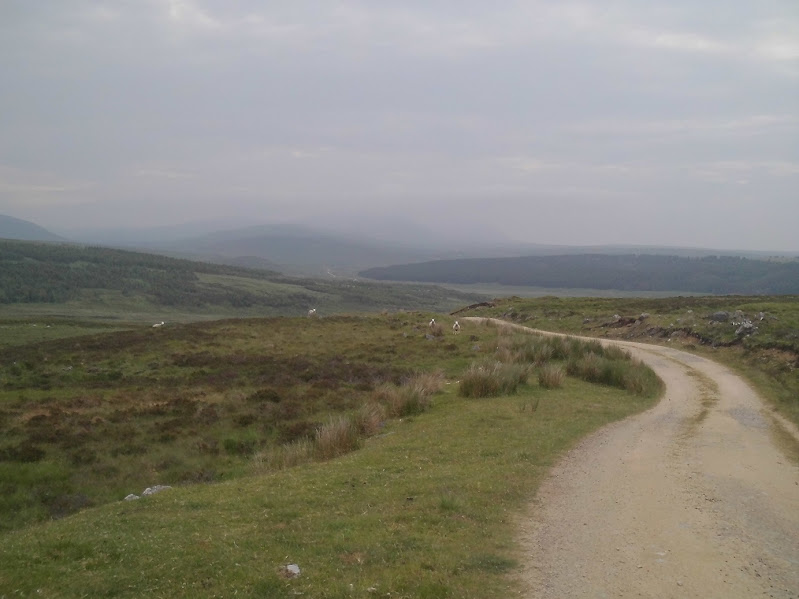
On the gravel road to Ben Armine Lodge. This is all part of the infamous Sutherland Estates whose factors, with the un-admitted but evident support of the Duke himself, were responsible for some of the worst depredations of the Highland Clearances. Most famously was the incident that ended up with several families getting driven (i.e. burned) out of their houses and having to shelter in Croik church. I reflected on this and my comparatively easy life wondering if such atrocities were really left behind. It was gloomy but dry, warm and breezy.
The lodge - a somewhat remote spot to live. Beyond here the track quickly deteriorated to a grassy trail that clearly saw little use. The good news was that everything was bone dry. After a bit of this I figured that 9pm was late enough and stopped to bivvy by the river.
A nigh on perfect spot - level, grassy and breezy enough to keep the midges at bay. I lay in my bag and read for a while, to the accompaniment of some fine whisky. Finally my eyelids drooped and I was out for the count. I had a good night but woke at dawn to light rain, a stiff breeze and low cloud. I zonked out again in the hope it would lift later. 7am saw me up for breakfast, packing up and moving. The rain was off and the cloud started to lift with a few breaks revealed to the east.
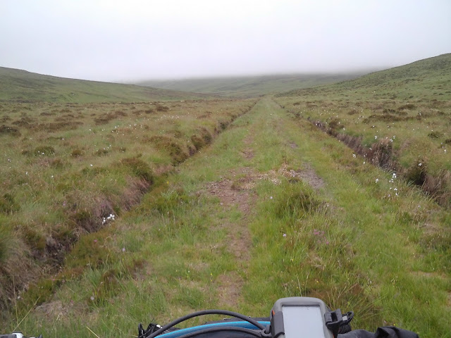
Mandatory trail shot. As far as I can figure, a typical stalkers path built in the victorian era that has been upgraded to an argo cat width around twenty or so years ago. This has now grown over heavily. I did see another bike track but after a few k the argo and quad tracks all turned off so it was just me and the tussocks. Fortunately I was on the destroyer of tussocks so all was well. That said I felt a degree of trepidation as I climbed into the cloud given my lack of intel on this trail. This took me back to the good old days when all we had was an OS map and the boundless enthusiasm of youth. We had no idea whether those beguiling black dashed lines would lead to an easy trail or a hideous death march. It was just a case of trying them and finding out!
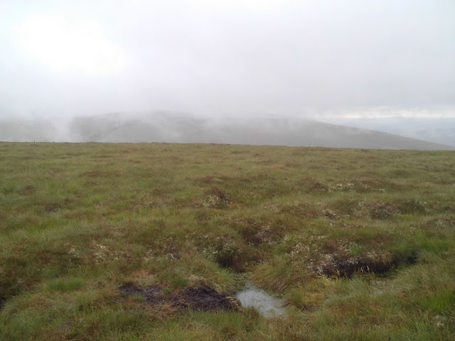
The view. A shame really as the views should have been amazing.
At least it was dry so in actual fact the riding fairly straightforward. I was keeping an eye out for a turn off to the left that would climb out of this glen (actually called the Strath na seilge) over to Loch Choire.
Somewhat dubious bridge which I rode across without thinking. Maybe that's the best way....
The lack of view meant much peering at the GPS to fathom the exact turning point. The trail wasn't immediately obvious until I crossed the river and started up it. But it was a lot vaguer and even more overgrown than the one up the glen. As I approached the summit the rain inevitably came on - a cold blatter that had me into full waterproofs - adding to the drama. However, as I started on the descent, the cloud suddenly lifted, the rain went off and a view was revealed. The track was still quite overgrown but well defined with only a few boggy bits (finally!) to negotiate.
Then I came across a locked gate. These seem to be plaguing my rides this year and are a bloody nuisance. There is no way anyone is going to get any kind of vehicle up here so why? Because the landowners still don't like the idea of the plebs wandering across their precious ground. The lock was corroded solid and the case cracked. I had a go with the leatherman pliers to break it open to no avail. I then picked up a large rock and after a few well aimed blows the lock split open and fell off. I launched its remains into the nearby burn, un-hooked the chain, proceeded through and re-secured it. There, that's much better. Then I came across this.....
Going back (or round) wasn't an option so I ploughed on through. It wasn't very long fortunately but it was shame that such a long length of trail should be spoiled by this short section. It ended at another locked gate! I swore loudly, fully and violently. Beyond there were piles of new fencing materials lying around but no tools and the the padlock resisted further rock smashing attempts. But it too was siezed to a point that it would never unlock again. Maybe the new fencing works would remove all of this and install nice self closing gates. Hmm. I heaved my bike over the fence and joined a well used track out to the loch. At one point there was a damp peat patch through which I rode, leaving a clear fat tyre print that would hopefully enrage the land owner to apoplexy.
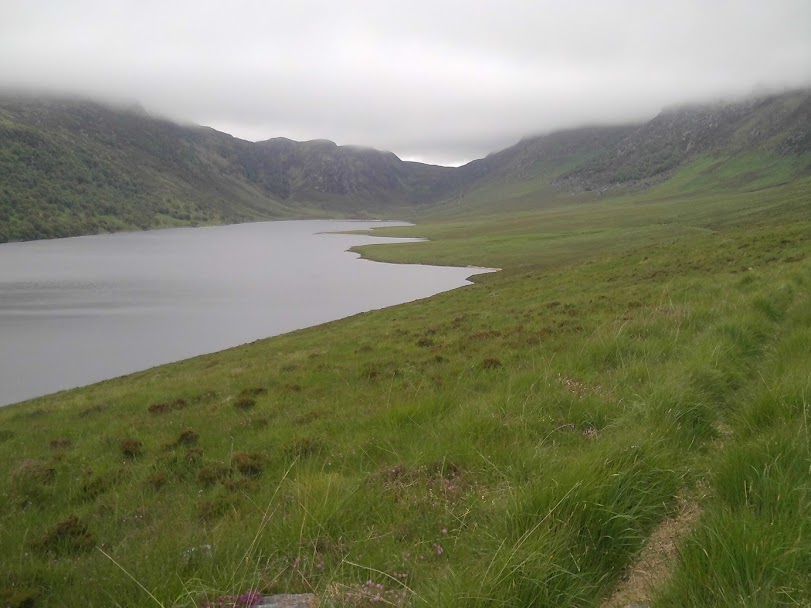
The beach! This is Loch Choire; its been yonks since I hit the sand so this was a bonus. Various argo cat tracks stuck to the shore to avoid the first of two foot bridges. The burn crossing looked a bit dubious so I figured the bridge would be a better bet. I'd noted on aerial photos that the bridges were still present but unfortunately they didn't indicate their condition!
Blimey this was very dodgy. All the planks were well rotted with several missing. I stepped very lightly across, aware of the depth of the river below me....
The next bridge was avoided as the river was shallow at the mouth into the loch. It's a shame as they are two fine structures which the estate will very likely have no interest in fixing. I wish our useless government would stop fannying about with road improvements and throw some dosh at getting such things fixed and maintained, for us the great unwashed.
Finally I hit the stony track on the north shore of the loch. This is on a lengthy route from the Crask Inn on the A833 to the B871 at Badanloch lodge. The Great North Trail actually shows this as an option but you really wouldn't want to take a gravel bike along here. I got up the climb clean (gears!!) and finally got some views.
Looking up
And back down.
The descent was a nice singletrack but then the trail faded into the undergrowth with just a variety of trampled lines to follow. The 'track' re-appeared where the land levelled out. Today it was still bone dry but evidence of much bog and peat would make the roll out to the road a schlep under normal circumstances. It still took a while but just as noon was approaching I hit the road by the Crask Inn after what seemed like a massive traverse. Actually 23 miles in total so not the longest I've done but a fair old way without tarmac all the same. I've passed the Crask Inn loads of times by motorcycle but never stopped. I was hungry after all of that lot so waited five minutes for it to open and dived in for cheap but cheerful food. Of course I also had to have a pint of Orkney Gold. More people arrived as I finished up, including two pairs of cycle tourists. It seems to be a popular spot for them being on NCN 1 and various bikepacking routes.
As I headed north the sky was clearing. There was even a hint of sun!
Clouds boiling over Ben Klibreck. I should have had a view of this substantial North Highland hill as I'd crossed the pass earlier so I guess that means I'll have to do this route again at some point.
One of several new windfarm schemes going up in this area. Anyone who thinks this is 'green' energy needs to see the environmental destruction these things cause and the gear needed to build them. It's not as if they generate much electricity either! What's worse is that the raised bog and wetland of Caithness and Sutherland is actually one of the worlds biggest absorbers of CO2. So why we are allowing it to be damaged in the name of preventing climate change defies all logic. Until you realise how much money is involved of course. It's big business for the generating companies as they have to prove that a percentage of supplied electricity is generated by so called 'renewables.' Then there is the whole carbon credits scam. So the high cost of installation and running is passed onto the consumer (i.e. us), they get big tax relief on the projects and likely other less visible incentives whilst their share holders make a massive profit. The absolute worst of all aspect of them is that the landowners get huge payments (we are talking millions per year across Scotland) for 'allowing' these turbines to go up on their land - real money for old rope and all payed for by us. Its a scandal that has been lost in the panicked rush for governments to be 'seen to be doing something' (a horrible phrase which basically means its got to look like they are doing something, without actually doing something) to shut the eco warriors up and pretend they are addressing climate change. It doesn't and they are not.
Anyway enough soap-boxing, on with the ride. Fully half a dozen cars passed me on the run up to Altnaharra. I've always wanted to cycle these roads and in the strengthening sun it was most pleasant. The landscape is much less dramatic than the west but the wide open views are glorious. At Altnaharra I turned left on the Ben Hope road. This is a great wee road running all the way to Hope on the north coast. It deteriorates to a near track like status further along it so is huge fun and blessedly free of other traffic as a result. To cap it all I was now in full sunshine with a stiff following breeze.
As I turned off the road onto the track to Loch Merkland and looked into these forbidding hills the Highland Trail route climbing into Glen Golly could be seen with the direct route to Lone also visible. I seem to have gained quite an affinity with these hills starting when I climbed them with my dad on a sunny day in 1988 and three passages on the HT. The contrast of these fearsome hills with the surrounding rolling moors was stark. Its a feature of Sutherland and Caithness - Bens Klibreck, Armine, Loyal and Hope all isolated from each other by a vast wilderness of raised peatbog and small lochs. I've never actually ridden the full pass between the Hope road and Loch Merkland, just the bit on the HT route and either early morning or in horrible weather or both. I reflected on the contrast between todays weather and what it had been like in May...
Gobernuisgach Lodge. The hut next to the oil tanks was used as an impromptu bivvy shelter on HT 2015 by Ricki Cotter and Stephen Sloof. It was full of dead deer carcasses apparently.....
I occurred to me to do the Horn route given the weather and dry trails. The direct route west to Lone was also a prime candidate for my onward route as I've never done this before. I could see it climbing steeply up the glen and I confess was stricken with a dose of laziness. Instead I twiddled up the track thinking I would spend some time along here to finally appreciate the landscape and the scenery.
The pass to Loch Merkland. I sat here eating food for some considerable time. The sun was shining and the breeze kept the insects at bay. The dramatic peaks of Ben Loyal were shrouded in cloud to the north but it still made for a pleasant break from the labours of that mornings trail.
Eventually I took off and bombed down the track to Loch Merkland. Riding down the road I noted the climb over to Glen Cassley, my next destination. It looked huge! I came this way on a tour in 2010 (in rubbish weather) so I knew roughly what was coming. I took it slowly so actually got up in good order, despite the hugeness of my tyres.
From the top looking back to the Northern Hills
I hammered the descent then took stock. Next up was another big climb and another tough trail over the southern flanks of Ben More Assynt which also looked like it would go. I'd scoped this out during my Highland Trail route homework. Its actually on google street / hill view - part of the Central Sutherland Crater Walk - which covers the HT route right through to Glen Golly, so its a good resource for ID'ing bivvy spots and trail conditions. Given the dryness of everything and the weather I knew I should really crack on and bag this trail. But it was now 5.30 so I'd been going for 9 hours at this point and, crucially, I was on holiday. I've three times passed the Dam at the top of Glen Cassley and noted the near perfect bivvy spot just below it. It was sunny, breezy and I'd done enough. So I pitched up, went for a wander and generally lazed around.
Hydro electric dam and gear. Not without their own environmental impact but its a lot less than stupid wind turbines and at least they produce lots of power, reliably, given the preponderance of water in the Scottish landscape. Of course the real answer is to use less power but given the headlong dash towards electric vehicles (another dead end) this seems to be an impossible dream.
Oh well, you can't have everything. As I started to make tea the wind dropped and the midges appeared. Not the horrendous storm I'd faced in Drumtochty Forest a year ago but bad enough to have me scampering about the place whilst the stove did its job. The breeze came and went a bit but eventually I dived into the tent and relaxed with food and whisky as the little bleeders battered fruitlessly at the mesh.
The wind got up later allowing further wanderings. But when I woke in the early hours to go to the loo it was still again. I was in and out sharpish but a while later I became aware of numerous itchy bits - clearly I was being bitten! switching on my headtorch revealed your worst nightmare (well not really but you know what I mean) - a cloud of the swines above me, inside the tent!! Arrrgghhhh how did that happen. The door was firmly shut so they must have sneaked in with me. I spent twenty minutes swatting every one of them before finally crashing out again.
The morning brought much wind and more low cloud. As I'd predicted I had a further failure of motivation to tackle a high level trail as I wanted the views. There are a few options to do this as a day ride or part of a longer tour so it could wait for another day when the weather was better. Instead I had a lazy cruise down the glen checking out a few good bivvy spots, another dodgy bridge and Achness Waterfalls, near where I'd bivvied in May.
Thereafter a steady climb and descent back to Lairg.
Most of this route was actually on road, distance wise. That didn't make me regret bringing the fatbike however as it had rolled through all in its path without any fuss. I didn't even bother pumping the tyres up for the road sections but the rolling resistance was of no issue and it was super comfy.
What next? My vague plan had been to stay up here and do some hill walking or bag some north coast beaches - anything to avoid the drag back down the A9. Not as easy as you might think. The campsite a few miles out of Lairg looked perfect for my needs (on a raised moor with plenty of midge beating breeze) but a sign at its entrance announced the toilets and showers were closed due to refurbishment. Fabulous - Scottish Tourism at its best. This was of no use to me being tent bound and in dire need of a shower so I returned to Lairg to fire up the phone and see if anything else was available. In short - no. Any accommodation was booked up and I couldn't face the north coast campsites, doubtless packed with people doing the wretched NC500. Some texting with my friends in Speyside meant I could head there but ideally not until the Tuesday evening. Finally I phoned the campsite at Evanton which I've stayed at on a couple of bike tours and most recently on the motorbike tour in 2019. Glory be, they were empty so I booked a pitch. An hour later I arrived and got the tent up in double quick time, given the somewhat threatening clouds. This is not far out of Inverness so I figured it would be NC500 free. A chap on a touring bike turned up so we chatted a bit whilst he set up.
It turned out he was 5 weeks into a tour around Scotland having done the Western Isles and Orkney and Shetland and was now making his way back down south. I was slightly alarmed when he seemed to have no knowledge of any of the NCN and I got the feeling he had been on the A9 all the way south. I implored him to use NCN 1 to go along the Moray coast rather than the horrible A96; or at least one of the many back road alternatives but his route knowledge seemed vague. Oh well, hopefully he'd realise that Scottish Trunk Roads are to be avoided at all costs.
Just then a couple of cars pulled in next to mine. I got a sinking feeling observing the lowered suspension, loud exhausts and horrible wheels. On cue four young kids got out and immediately started the Glaswegian ned banter (an F word every other). They then proceeded to walk right up beside my tent and start pitching their cheapo Go Outdoor specials. Given that the rest of the field was empty this was extremely frustrating. Biting back words along the lines of "It's not T in the park you know" I went for a walk whilst they fumbled up their tents.
I'd discovered the Black Rock Gorge, just up from the campsite, which shares the same name, a couple of years ago. This turned out to be dramatic so was worth a repeat visit. At the top it's only a few meters wide, sometimes less than two but fully 40m deep. You peer down this dark crack in the ground that extends for several hundred metres, the burn a rushing torrent far below. I wandered around for a bit but a fine drizzle came on so I returned to the campsite before it turned heavy. My neighbours had managed to get the tents up and I overheard (inevitable given that they were ten feet away) that they were doing the NC500, causing me to once again curse this tourist abomination. They were planning on 'wild camping' (their words) up north which made me smirk. Anyone who knows the roads on the North Coast will also know that its pretty much the road, a big drainage ditch and then several thousand square miles of raised peat bog. Roadside camping is nigh on impossible and when you throw in wind, rain and midges it was clear that they would be in for a terrible trip given their crap tents. As I started on making tea they departed for the shop and then the rain came down heavily. I retired to my spacious and totally waterproof Vango spirit 200+ relaxing with a few beers and fine food. The rain was my saviour as it kept them in their tents and quiet.
The rain was on and off all night but I slept OK despite the chatter from next door. The morning was sunny so my tent mostly dried as I had a leisurely breakfast and packed up. The neighbours had clearly had a rough night as various sleeping bags were draped over cars to dry and the cheapo pop-up tent looked like it had been water-logged. I did consider offering some sage advice about where (and how) to camp up north with a view to steering them away from the inevitable fires and mess but they were such a surly lot I decided to leave them, and the site, to it.
Next up the beach. The drive to the Moray Coast was a bit slow and I had one aborted attempt to park in Culbin forest; foiled by having no cash for the parking ticket machine, before rocking up to Findhorn, home of a hippy commune, a bunch of wannabee eco-warriors and much sand. I'd thought of camping here the previous night but the site was mobbed so that was a good miss. The beach car park was also busy but I abandoned the car easily enough and pedaled into the dunes.
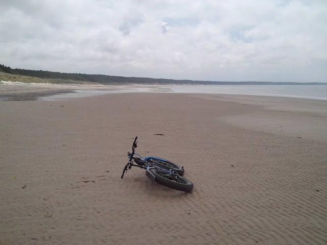
This is actually the first beach ride I've done since New Years Day 2020, also here, so this was fab. I traced a random route through the dunes, rode along the top of the coastal slope for a bit, and then plunged into Roseisle Forest and its network of sandy singletrack.
After getting lost in the woods for a while I emerged at the main car park to be greeted by the fabulous site of a burger bar. And not the usual purveyor of abattoir floor scraping efforts either. So I sat in the coolness of the woods eating a fine Steak (Aberdeen Angus of course) burger in a nice roll, a coffee and best of all a double biscuit (two layers of shortbread with jam in the middle, icing and a jelly to on the top)
Then it was off again. I'd noted mist rolling in from the sea (to coin a phrase) obscuring Burghead so when I eventually reached this small coastal town I only paused for a bit before dropping onto the beach and heading back west with a fine tailwind.
Flat sand riding may seem like a very dull thing to do but I love it. I cruised along the shore looking at the waves coming in and the opposite coastline slowly disappearing into the mist. I popped a few wheelies (mandatory on sand below the tide line) and generally relaxed. Findhorn was also fast disappearing into the fog so after riding right round the shore into the harbour I threw the bike back in the car and headed for my pals place at Aberlour.
Socialising followed and the next day me and Rob tried a new route in the Cromdale Hills. The weather finally caught up with me here but a steady drizzle rather than the predicted deluges. Evidence of such downpours was manifest however so I felt quite lucky really. After a steep climb we emerged into... a cloud. Our route would follow the ridge line west in the hope of picking up walking trails linking Creagan a Chaise to Bridge of Brown.
Less than inspiring. There was a vague quad track for a bit but it stopped at a small cairn. Beyond was extreme tussocks, heather and bog. The cloud kept lifting (briefly) to reveal the further hill which looked like peat hag central. I guess if it had been dry and clear I'd have been more motivated to plough across all of this. Rob was but I persuaded him that it would be far better to do it with a view. Eventually he concurred and we bombed back down to the truck. The day was still young so we drove onwards to Bridge of Avon with a view to doing the western most bit of the loop, exploring some ruined cottages in the process.
The rain came and went but we were only out for an hour or so so that was alright. Later it cleared up and we actually managed a barbie!
My final day was spent exploring singletrack near to Grantown. This looks like a bit of an un-tapped resource as there were trails everywhere. This was a fine end to what had been a relaxing trip away from home. After tea at R & I's I had a very easy drive home on empty roads, nicely compensating me for the troubled trip north.










No comments:
Post a Comment